ML advances for remote sensing/geospatial data
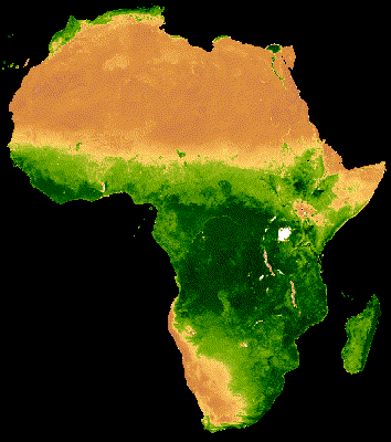
Satellite Earth observation (EO) datasets are rapidly gaining interest in the AI community due to the massive datasets involved as well as the opportunities for addressing urgent challenges related to climate change, the environment, agriculture and food security, and humanitarian needs. However, there are currently many challenges for developing AI systems that use EO data, namely, limited public labeled datasets, a lack of harmonization across labels and source data, substantial effort required to make EO data “AI-ready”, and models that do not learn geographic context or exploit spatial metadata. My research focuses on algorithmic advances that efficiently learn from sparse, heterogeneous data and incorporate location/other metadata to enable models to learn geographic context.
Agricultural land cover/land use classification and monitoring
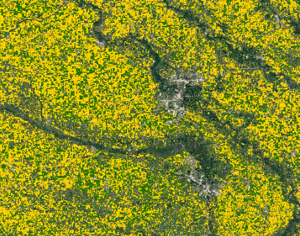
Information about where and which types of crops are growing in addition to how they are growing and expected to perform (e.g., crop conditions, expected yield, farming practices) is critical for informing agricultural market decisions and ensuring global food security. Machine learning and remote sensing data can be used to create crop type maps and other data products that provide information such as crop-specific land cover classifications to enable timely analysis at field scales throughout the growing season. These data products can be used in downstream analyses and decision-making such as agricultural production statistics, early warning for impending food shortages, pest/disease monitoring, crop damage assessment, and more.
Novelty/anomaly detection
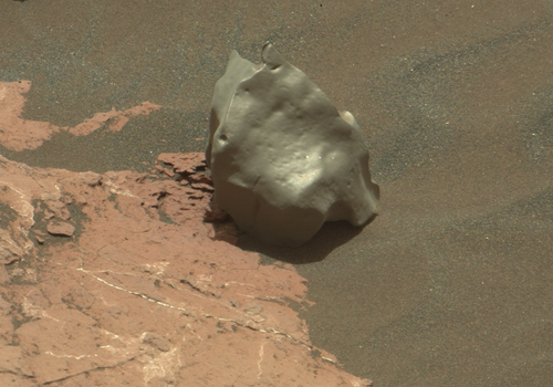
Automatic detection of out-of-distribution (OOD) samples or features is universally needed when working with scientific datasets. This capability can be used for cleaning datasets, e.g., flagging ground-truth labels with GPS or human entry error or identifying wrongly categorized objects in a catalog. It could also be used for discovery, e.g., to flag novel samples in order to guide instrument acquisition or scientific analysis. My research focuses on developing methods for automatically detecting novel or out-of-distribution samples in scientific datasets in a variety of domains including planetary exploration, pests/disease in crop fields, volcanic thermal anomalies, natural hazards/disasters, and more.
Change detection, mapping, and area estimation
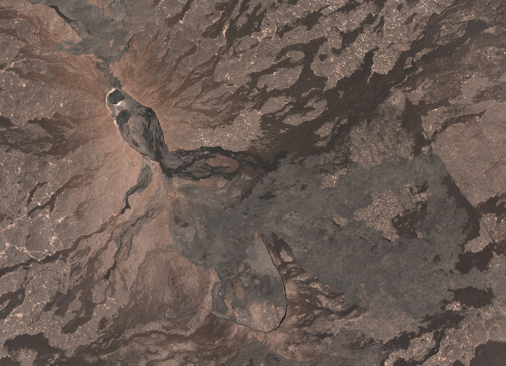
Change detection in remote sensing involves automatic identification of the occurrence, extent, and/or type of change on the Earth's or another planet's surface. Such methods can be designed to detect rapid changes (such as impact craters) or changes that occur more gradually over time (such as slow-moving landslides). My research projects also involve detecting semantic changes in land cover or land use categories, such as farm abandonment/planting status or conversion of forests to cropland, and strategies for estimating the areal extent of that change to inform policy- and decision-making (e.g., food security assessments).
Street2Sat: Co-locating ground object detections with satellite images
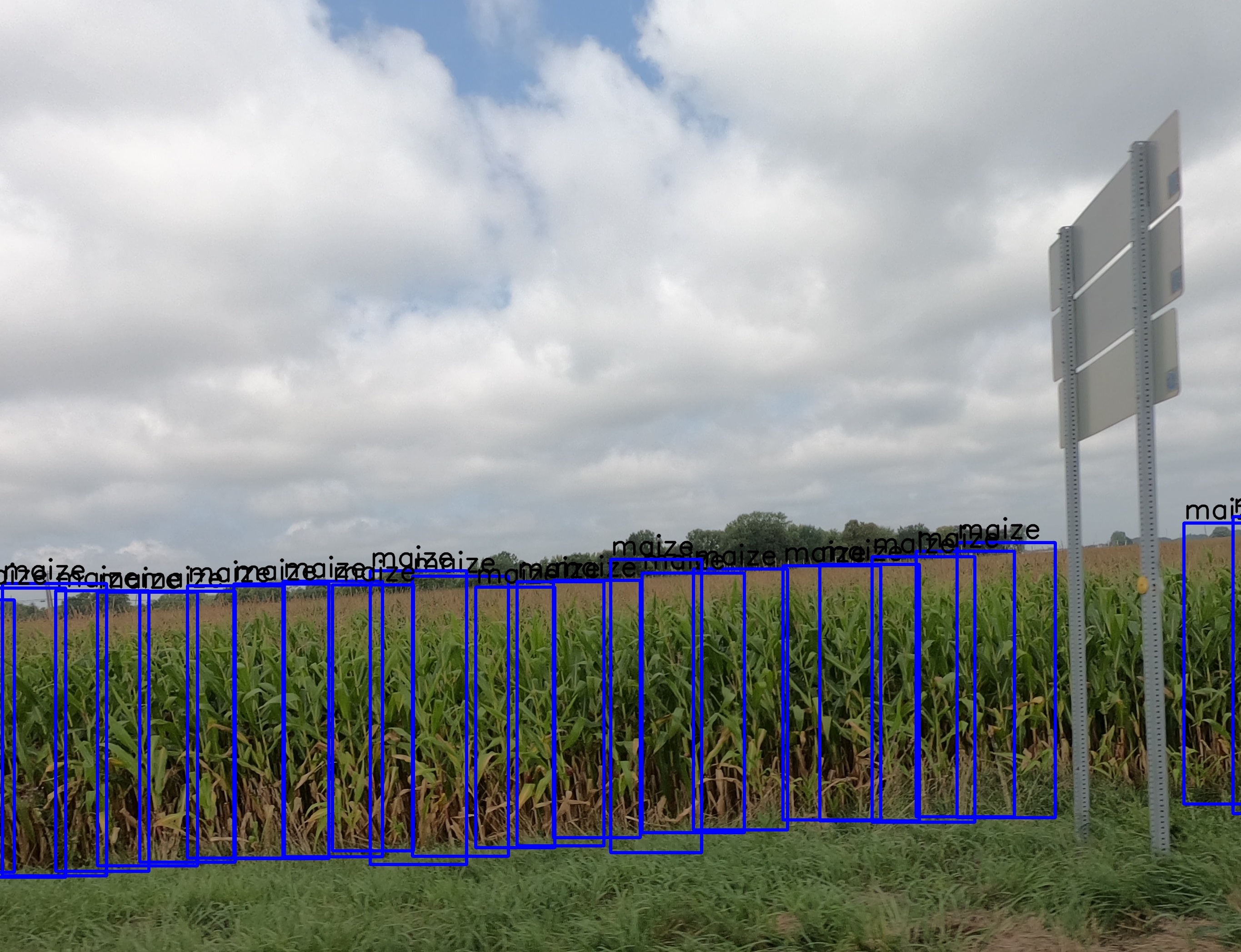
In many cases, ground-truth annotation is required to determine the label that should be associated with a location in a satellite image due to the spatial resolution and overhead nature of satellite images. Such labels are scarce and are often collected opportunistically and on a project-to-project basis; transformative approaches are needed to more scalably and affordably collect ground-truth labels, especially in regions currently under-represented in machine learning datasets (e.g., Sub-Saharan Africa). We are developing a solution called Street2Sat, which transforms a set of geo-tagged images collected from a vehicle on the road to a set of labeled geo-referenced points with locations corresponding to the object(s) of interest detected in the images. These points can then be used as labels for satellite images.
Geographic Fairness
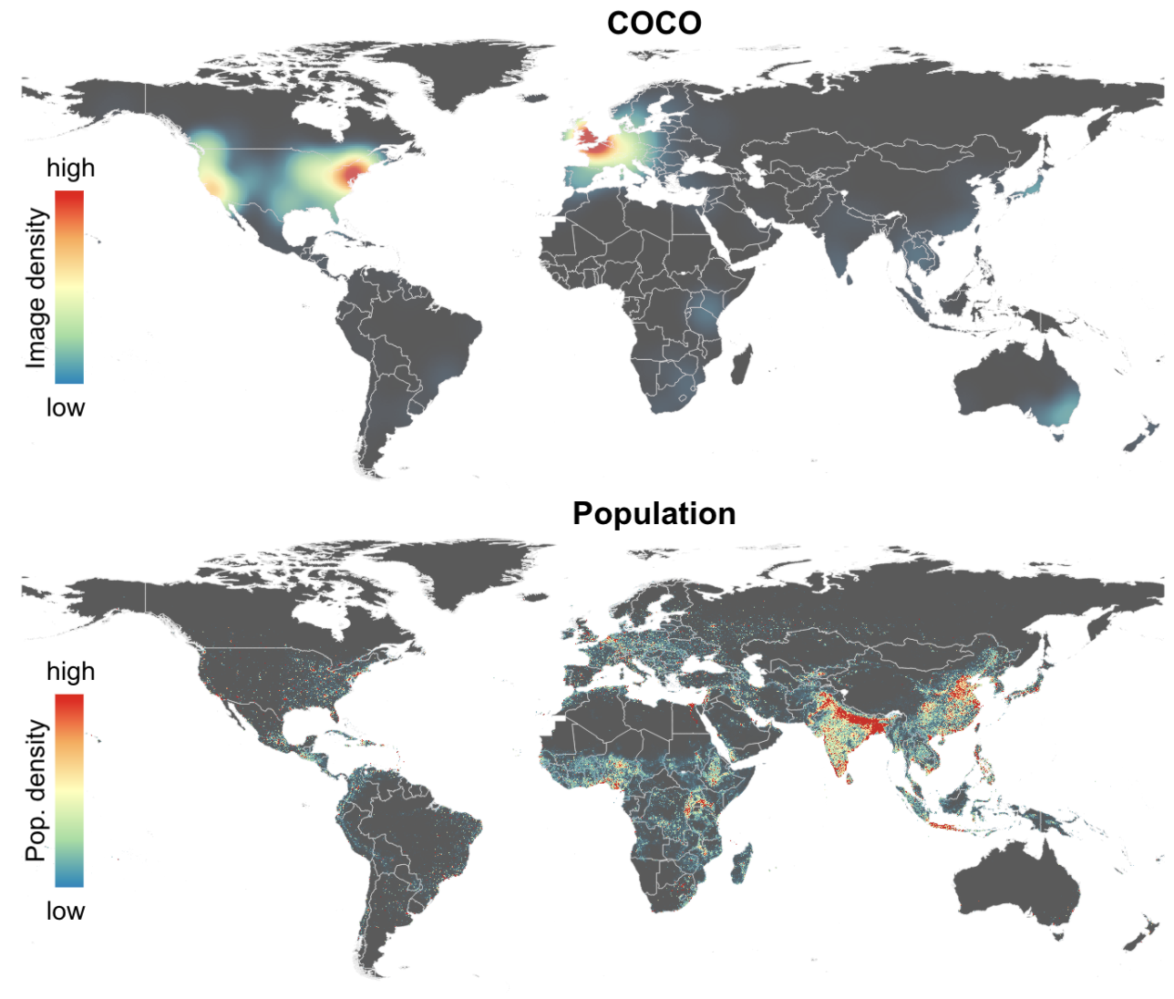
Fairness and comparative performance of AI systems can be evaluated across sub-groups of society that differ by factors such as sociocultural identity, age, gender, health status, geography, income, and education. Geography is a particularly important dimension because it is correlated with many other factors such as income, access to infrastructure, health status, and education. Geography also influences the appearance and context of objects or classes in datasets used in AI. Existing ML benchmark datasets and models have been shown to have substantial geographic bias in addition to race, gender, and language, resulting in AI systems that work well for some regions and not others. My research involves creating new datasets and algorithms designed to mitigate such biases and create geographically fair AI systems.
AI-Assisted Exploration
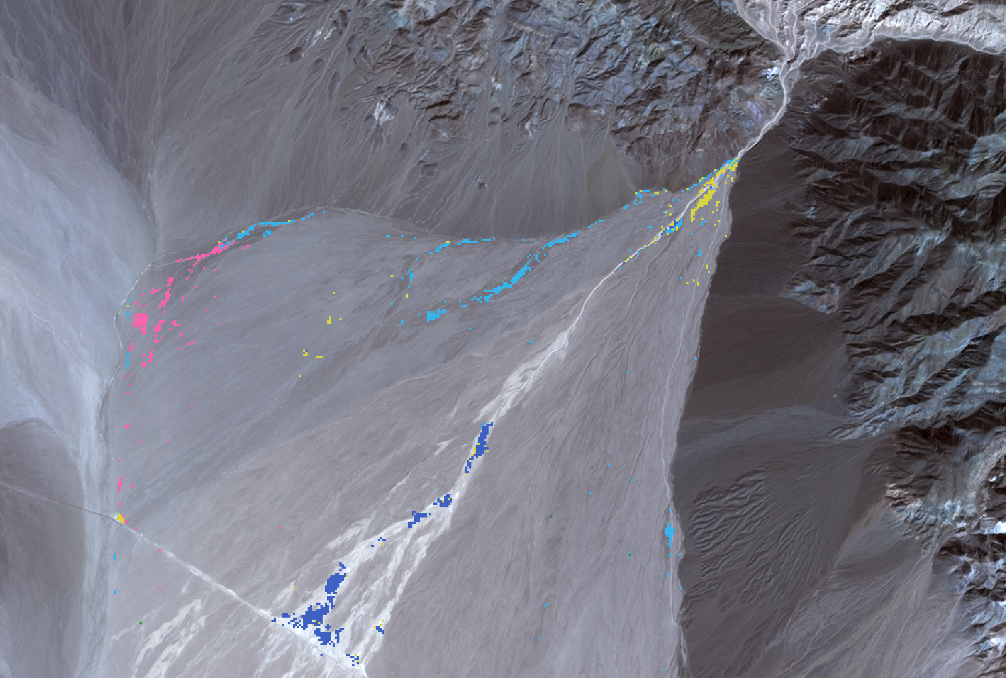
Planetary exploration missions seek to investigate and understand never- or under-explored landscapes and worlds. AI can assist scientists and mission teams in this goal and enhance scientific discovery by prioritizing observations of scientific interest, automatically selecting targets for observation, revealing patterns and relationships in high-dimensional datasets, and more. My research projects involve developing AI systems that augment the capabilities of planetary missions and scientists using novelty detection, unsupervised clustering/mapping, change detection, and more.